Iceland Volcano Eruption 2025 - Latest Updates
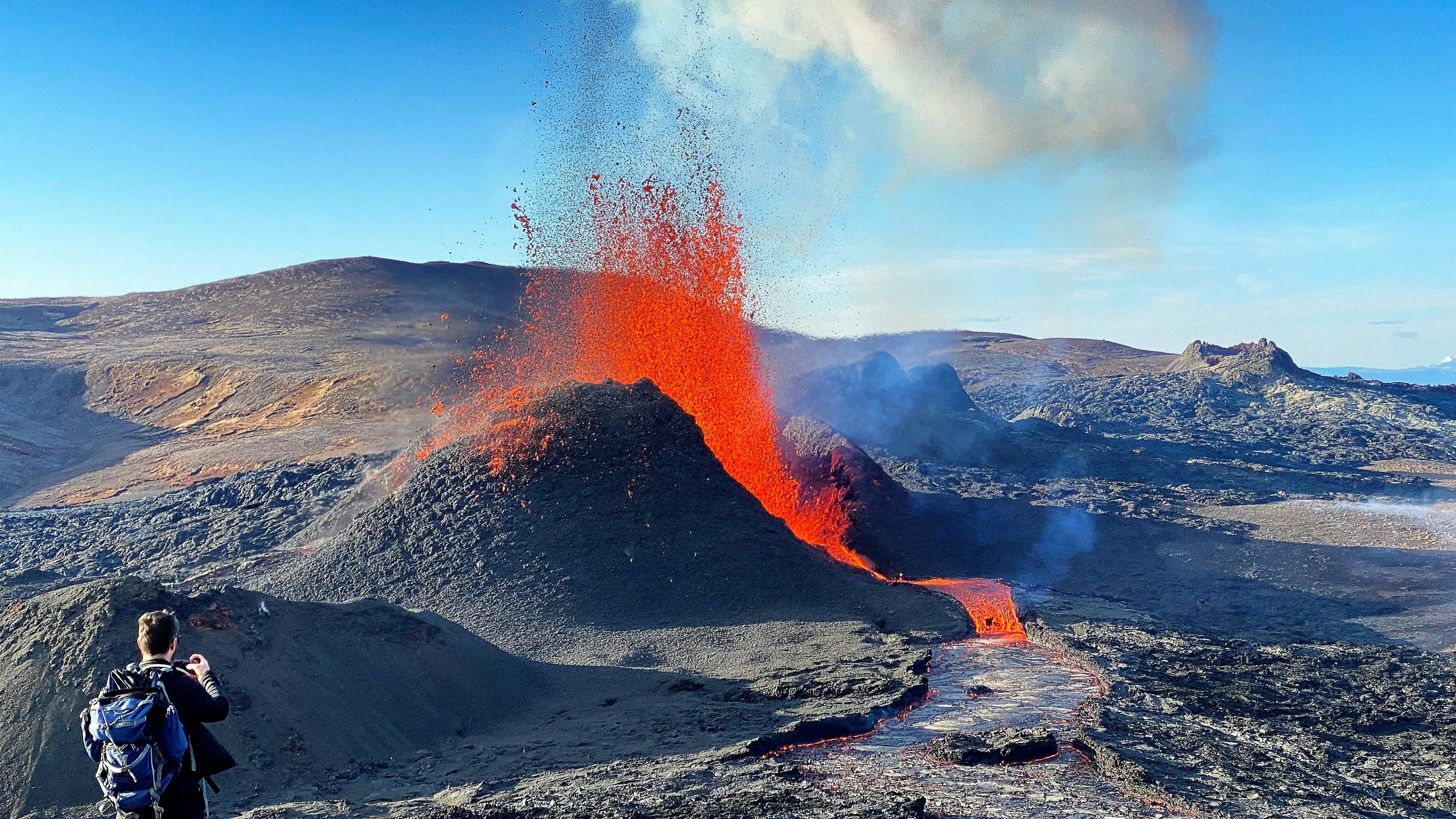
Table of Contents
- 1Current Volcano Status: April 9, 2025. Recent Eruption Had No Impact on Travel
- 2The Timeline of the Reykjanes Volcano Eruptions
- 3The Grindavík Eruptions
- 4What Happened to the Grindavíkings?
- 5The Scientific Importance of the Reykjanes Eruptions
- 6The Ecological Impact
- 7The Economical Impact
- 8The Impact of the Volcanic Eruptions on Iceland’s Overall Safety
- 9Is Gas Pollution a Danger?
- 10Volcano Tourism Amidst Changing Dynamics of Iceland's Eruptions
- 11The Traveler’s Perspective on 2025 Volcanic Eruptions in Iceland
- 12Questions and Answers about the 2025 Iceland Volcano Eruptions
Current Volcano Status: April 9, 2025. Recent Eruption Had No Impact on Travel
A brief eruption began on April 1, 2025, at Sundhnúksgígar, a crater row just north of Grindavík. The activity slowed down quickly; by April 3, there was no visible volcanic activity.
This marked the eleventh eruption on the Reykjanes Peninsula since 2021—and the eighth along the Sundhnúk crater series.
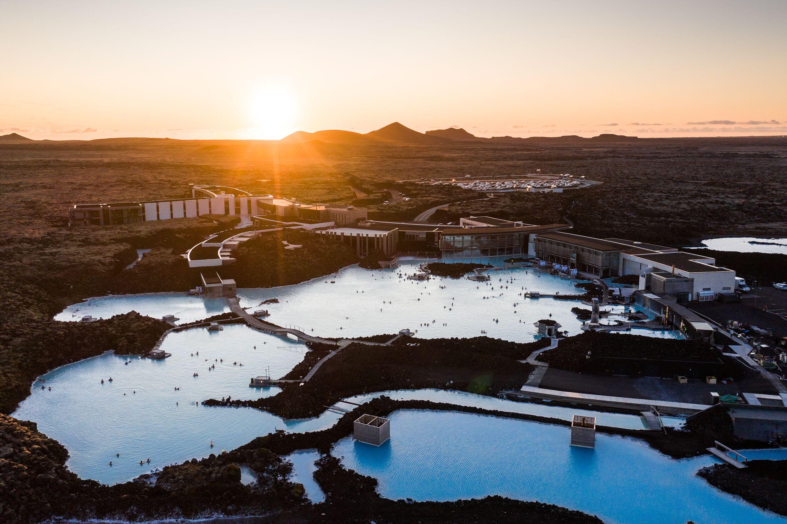
There was no disruption to travel or air traffic, and the Blue Lagoon has since reopened.
Tours across the country are operating as usual, and the Flybus airport transfer is running normally.
Given the recent eruption patterns, further activity is expected in the coming months, though the exact timing remains uncertain.
The Timeline of the Reykjanes Volcano Eruptions
The Wake of Fagradalsfjall
Iceland, renowned as one of our planet's most active volcanic regions, experiences eruptions approximately every four years on average. However, due to their frequency, recent volcanic activities on the Reykjanes Peninsula have captured worldwide attention.
The 2021 eruption at Fagradalsfjall volcanic system ended an 800-year period of dormancy on the Reykjanes peninsula, Iceland’s southwestern peninsula that hosts the international airport and the world-famous Blue Lagoon.
This first eruption, named Geldingadalir, occurred in an uninhabited area and posed no direct threat to human life or infrastructure. This eruption, lasting for about six months, became a global spectacle and served as a valuable source of information for geologists and volcanologists.
Following the 2021 event, two more eruptions, Meradalir and Litli-Hrútur, occurred in the same volcanic system over the next two years. These eruptions continued the pattern of gentle effusion seen in 2021, but lasted only for three weeks each.
Their non-explosive nature allowed lava to flow smoothly, making these eruptions safe to observe from a distance. They took place in an uninhabited area, where local authorities established designated hiking trails to allow the public to witness the phenomenon safely.
As a result, tens of thousands of visitors trekked to these sites, experiencing the volcanic eruptions firsthand. For many, this journey became an intensely memorable and unparalleled travel adventure, likely etching itself as a once-in-a-lifetime experience in their memories.
This type of episodic volcanic activity is expected to persist for years, possibly even decades, as part of the ongoing reactivation of the Reykjanes volcanic system.
The Grindavík Eruptions
However, the situation took a turn as these initially tourist-friendly volcanic events began to pose threats to the local community. In late October 2023, the Icelandic Meteorological Office recorded a surge in seismic activity. Unlike previous 2021/22 eruptions, the data suggested that this time, the lava might be accumulating directly underneath a small town called Grindavík, home to nearly 4,000 residents. A precautionary evacuation of Grindavík was ordered.
In December, a volcanic fissure eruption occurred approximately four kilometers northeast of Grindavík. While the eruption's intensity diminished rapidly, concluding after three days, another fissure erupted in the same crater chain, in January, 2024, resulting in lava engulfing three residential houses.
Due to the timely evacuation efforts, the houses were all empty. By the following morning, the lava flow towards the town had halted. The eruption in the initial, longer fissure also ended after less than 50 hours.
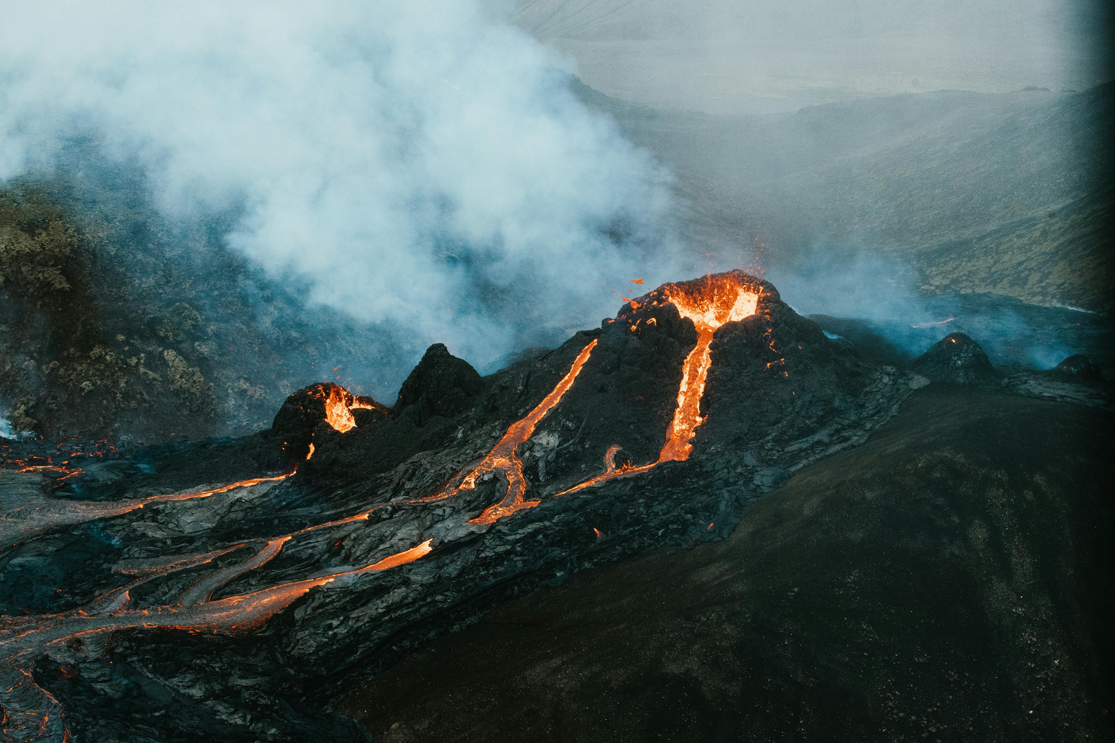
Further volcanic eruptions occurred at the Sundhnúkagígar crater rows this year. The February eruption was brief, lasting less than 24 hours. In March, an eruption began with intense magma discharge and continued for nearly two months. After a short break, the next eruption occurred in May and featured impressive lava fountains, with activity consolidating into one vent before ending after 24 days. The August eruption near a previous site started with a long fissure but declined quickly, lasting 14 days.
The next eruption started on November 20. It concluded on December 9th and lasted 18 days in total.
The town of Grindavík was evacuated in time and has remained uninhabited ever since.
What Happened to the Grindavíkings?
The residents of Grindavík and the surrounding areas have been on an emotional rollercoaster ever since the first eruption occurred in 2021. They have earned a distinctive nickname - the "GrindaVíkings." Their nickname has become a symbol of their enduring spirit and the solidarity that defines their community.
The impact of the recent volcanic activity has been devastating. The infrastructure of the town has been severely compromised, with cracked and broken walls and numerous hidden holes beneath the ground, leaving much uncertainty about what other dangers might lurk unseen.
Locals are forced to seek new homes permanently. However, in these challenging times, the strength and solidarity of our society have shone through. Residents of Grindavík have been offered places to stay, ensuring that no one is left without shelter or support.
The government has also stepped in, taking measures to alleviate the financial burden on the affected families and pay off their now uninhabitable houses.
These collective efforts to help the residents of Grindavík highlight not only the resilience of the Icelandic people but also their strong commitment to supporting each other through even the most difficult times.
Guided tours to Grindavík
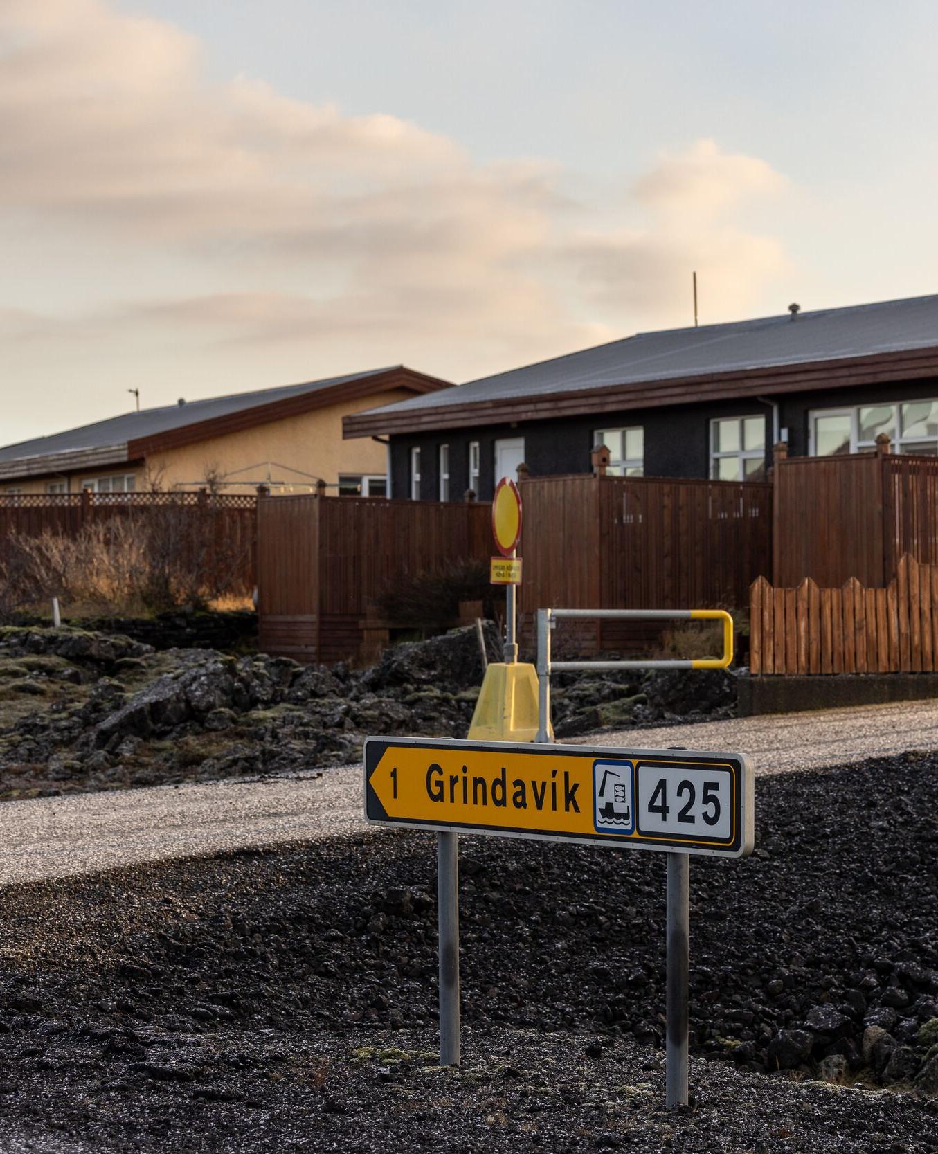
In November 2024, authorities decided to reopen Grindavík to visitors. Guided tours offer a safe opportunity to explore the town and witness the aftermath of recent earthquakes and volcanic activity.
Although only a few houses were engulfed by lava, the town became uninhabitable due to earthquakes, damage to buildings, fissures opening in the ground, and an uncertain future. Despite this, some residents still plan to return as soon as it's permitted.
The Scientific Importance of the Reykjanes Eruptions
From a geological perspective, these eruptions have been invaluable in understanding shield volcanoes, known for their gentle slopes and effusive eruptions. The lava’s composition reveals insights into the mantle source and tectonic activity, showing that recent magma is distinctly different from past eruptions.
The last volcanic activity here occurred between 1210 and 1240, fueled by a different type of magma that sustained eruptions for centuries. Now, with an entirely new magma type, scientists question its potential impact. Evidence suggests we are at the start of another long volcanic period, but its duration remains uncertain.
This is the first time such an event is being closely monitored in real time, with experts analyzing magma composition and seismic signals around the clock. Understanding when the current magma formed and why it differs from past eruptions is key to predicting future activity. Decision-makers and society eagerly await answers, especially on when another eruption might occur.
While we can't see the future, scientific observations and data are crucial for refining predictive models and assessing volcanic hazards. These eruptions have also strengthened international collaboration, accelerating advancements in volcanic monitoring and research, highlighting the importance of ongoing studies in volcanology.
The Ecological Impact
The recent eruptions offer a unique opportunity to observe the ecological transformations that can arise from volcanic activity and how local ecosystems adapt to volcanic disturbances.
In terms of air quality and climate, these eruptions have had minimal impact, given their effusive nature and relatively low emission of volcanic gases.
As the lava flows from these eruptions cooled and solidified, they began to lay the foundation for new landscapes. However, while creating new landforms and potentially enriching the soil with minerals over time, the lava flows initially destroyed existing habitats for plants and wildlife, leading to a loss of biodiversity in the affected areas. However, these dramatic changes can offer valuable insights into ecological succession and resilience.
Some of these eruption sites have also become tourist attractions and hold great educational value, enhancing public and scientific understanding of Earth sciences.
The Economical Impact
The Reykjanes eruptions had a varying impact on tourism and the economy, influenced heavily by the global media portrayal.
In 2021, during the peak of the COVID-19 pandemic, the initial eruptions had little effect on tourism due to existing travel restrictions. However, as travel resumed in 2022 and 2023, the Reykjanes eruptions emerged as a significant tourist attraction. The eruption sites drew thousands of visitors from around the globe, boosting Iceland's post-pandemic economic recovery.
The situation shifted in late 2023 and 2024 when eruptions threatened infrastructure, notably the town of Grindavík and the visitors' beloved Blue Lagoon. International media coverage, often exaggerated, heightened perceptions of risk, leading to an uptick in travel cancellations. Despite no disruptions to air traffic or any impact on tour operations whatsoever, this media-driven perception adversely affected our tourism industry.
Iceland's tourism has experienced a significant decline compared to the forecast, primarily due the exaggerated and negative news coverage of the events in the international media, and disruptions at the the Blue Lagoon.
The Impact of the Volcanic Eruptions on Iceland’s Overall Safety
The Reykjanes eruptions, aside from impacting the residents of Grindavík, have had little effect on Iceland's tourism or on local’s lives in general. The nearby Blue Lagoon has been taking brief closures intermittently as a precautionary measure, but apart from these temporary shutdowns, the spa has remained largely unaffected.
The most notable disruption caused by the eruptions was a temporary warm water shortage in the Reykjanes area following the February eruption. This occurred when the flowing lava overran water pipes, cutting off the supply. Remarkably, the response to this infrastructure damage was swift and efficient. New pipes were installed at an astonishingly fast pace and completed ahead of schedule within three days. This rapid response led to jokes that the world's best plumbers must be working in Iceland, highlighting the resilience and resourcefulness of the local services.
Some tremors have been felt in the capital, but these have been mild, only causing minor movements like shaking plants in apartments. Reykjavík and the international airport have remained unaffected by these volcanic events.
While the eruption sites were accessible during the first two years, they were closed in 2023 due to the unpredictable nature of the new eruptions and the danger of fissures opening in the ground, which sadly claimed the life of a local worker.
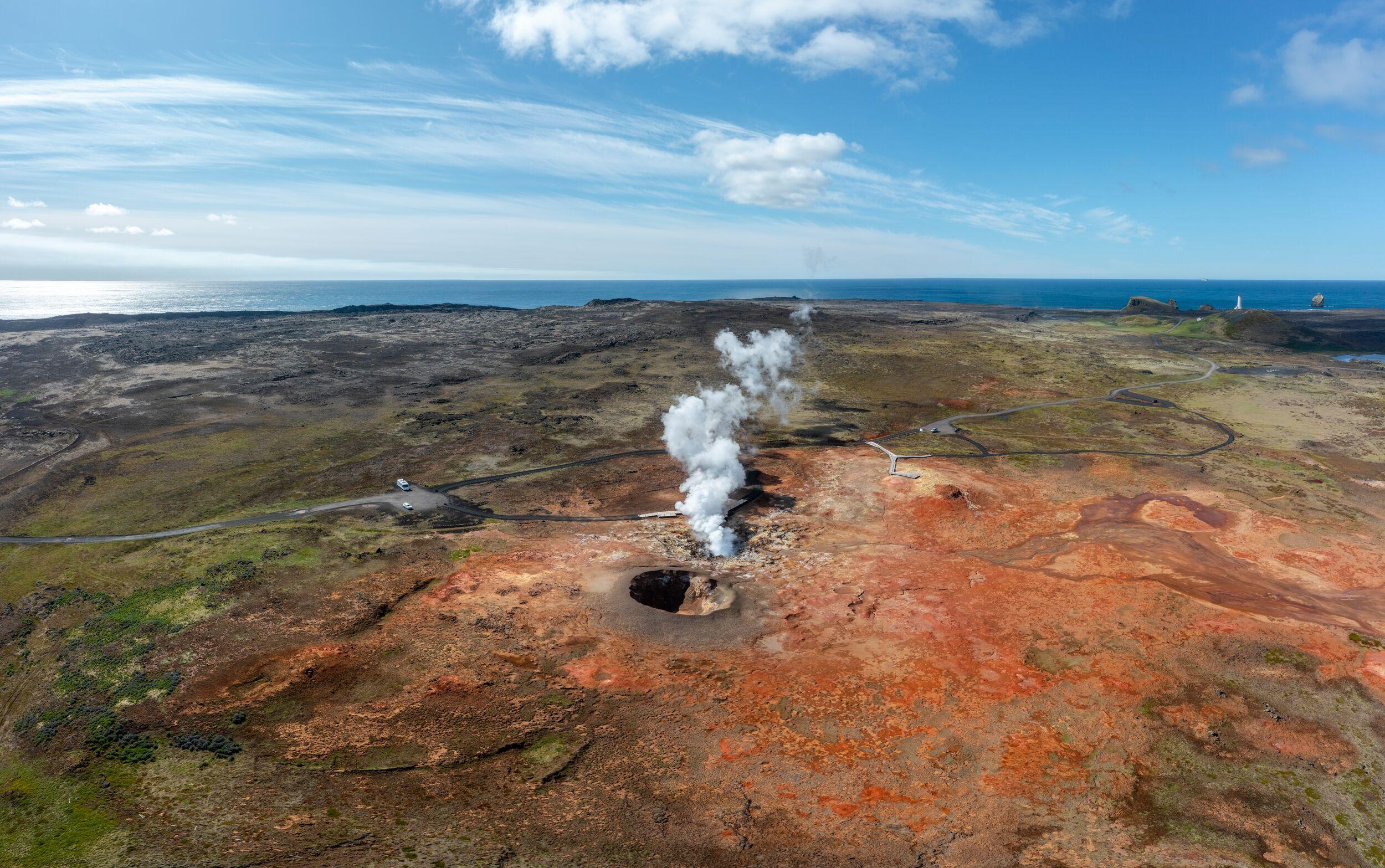
Is Gas Pollution a Danger?
During active eruptions, gas pollution poses a concern in the immediate area of the eruption site. The range of gases released, including sulfur dioxide, carbon dioxide, and other volcanic gases, can be harmful, particularly for people with respiratory issues or sensitivity to air quality.
However, Reykjanes peninsula, being largely uninhabited and known for its windy conditions, assists in swiftly dispersing these volcanic gases and minimising their concentration in the air. This means that although volcanic gases are highly concentrated at the eruption site, the smoke dissipates rapidly, posing no issues just a few kilometres away.
Occasionally, wind patterns shift and direct the gas pollution towards populated areas, including Reykjavík. In such instances, residents, especially those suffering from respiratory sensitivities, might experience discomfort. Real-time pollution maps are available to keep both residents and visitors informed about air quality.
Volcano Tourism Amidst Changing Dynamics of Iceland's Eruptions
Volcanologists suggest that the current phase of increased volcanic activity in Iceland could continue for an extended period, possibly lasting many years or even decades. Tourism in Iceland has remained steady, with some visitors on flights experiencing the remarkable sight of eruptions from their airplane windows. The allure of witnessing volcanic eruptions first-hand has led to the rise of 'volcano tourism', drawing numerous visitors to Iceland.
However, the 2024 eruptions have created a different context compared to those between 2021 and 2023. Earlier eruptions allowed for the quick establishment of official hiking routes to the sites, facilitating managed and safe viewing experiences. The recent eruptions, in contrast, have had an impact on local infrastructure and affected the lives of about 4,000 residents. Consequently, there has been a call from the local community for visitors to be mindful and considerate in their approach to these events.
The unpredictable nature of the most recent volcanic activities, characterised by ground fissures and eruptions with little warning, has led authorities to restrict access to the eruption sites, prioritising public safety in light of the potential risks. Authorities are urging the public to adhere to all safety measures and respect closures. This respectful cooperation is crucial for public safety and supports the authorities in managing the situation effectively.
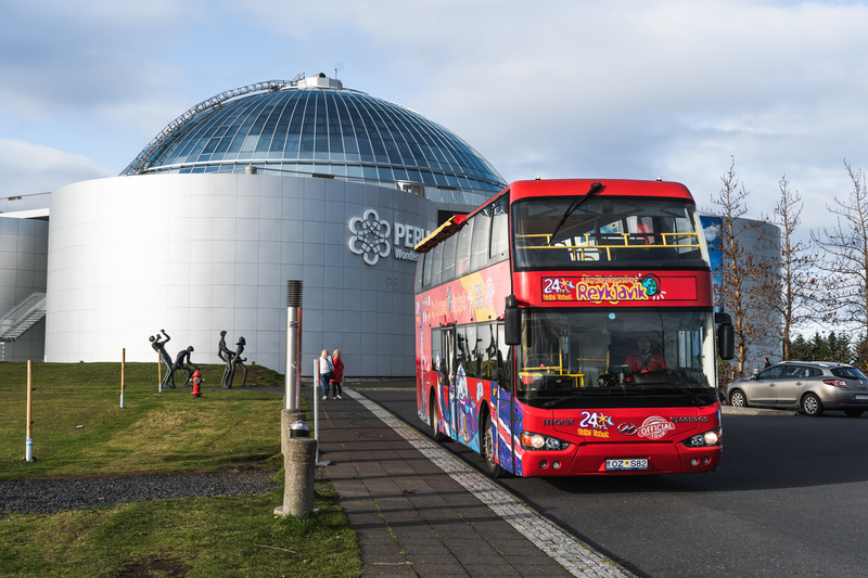
Nonetheless, safe viewing opportunities still exist at a distance. When an eruption takes place, spots like Perlan and Sky Lagoon offer vantage points for observing the new eruptions.
All risks and dangers are confined to the immediate area surrounding the eruption. Just a few kilometers away, life continues as normal. Travel remains safe and entirely unaffected.
The Traveler’s Perspective on 2025 Volcanic Eruptions in Iceland
From the view of locals and travellers, the volcanic activity on the Reykjanes Peninsula is expected to present a pattern of intermittent eruptions varying in duration. This activity weaves into the fabric of life here.
Eruptions may light up the horizon for a day or gently flow for months. Although accompanied occasionally by moderate seismic tremors, the area remains free from the threat of major earthquakes. This geological setting, where the earth's plates slowly drift apart, ensures a calmer seismic temperament compared to regions marked by converging tectonic forces.
Reflecting on the last three years, which have witnessed eight volcanic eruptions, it's noteworthy how life in Iceland, particularly in tourism and daily activities, has remained largely undisturbed.
Even the bustling city of Reykjavík and beloved tourist routes like the South Coast, Golden Circle, and Snaefellsnes Peninsula continue to thrive, unaffected by these natural events. The occasional closure of attractions like the Blue Lagoon has been but a minor hiccup.
Travellers are thus welcomed with open arms to Iceland, a land where nature's drama unfolds in the backdrop.
Travel to and within Iceland has not been affected in any way, and there have been no disruptions to flights during the eight eruptions over the past three years.
Stay Informed!
Subscribe now for updates and exclusive offers!
Watch Iceland's Volcanic Eruptions Live
While the eruption sites remain closed, you can still witness the action firsthand through live webcams strategically placed in key locations. Below is a mosaic view featuring four webcams, allowing you to immerse yourself in the spectacle. For additional links to more live feeds, check out the FAQ section below this article.
Questions and Answers about the 2025 Iceland Volcano Eruptions
Various webcams are available for live viewing of ongoing volcanic eruptions. These webcams also help determine if an eruption is currently happening. When a new eruption occurs, the cameras are promptly adjusted to display the new site. Therefore, if the camera views do not show any eruption, it indicates that there is no active eruption on the Reykjanes Peninsula.
The recent volcanic activities on the Reykjanes Peninsula have garnered global attention due to their frequency and the nature of these events. Since 2012, there is a volcanic eruption every few months and the frequency is increasing, suggesting a significant shift in geological activity in the region.
Yes, the first eruptions in the region occurred in 2021 and 2022 and were notable, attracting many visitors. The 2021 eruption ended an 800-year dormancy period on the Reykjanes peninsula.
Yes, volcanic activity, including the recent eruptions, is expected to continue and is considered a normal aspect of life in Iceland.
The residents of Grindavík are nicknamed "GrindaVíkings," symbolizing their enduring spirit and solidarity during the volcanic crises.
These eruptions are crucial for understanding shield volcanoes, the mantle source, tectonic activities, and improving predictive models for future volcanic activities. Notably, the recent series of eruptions on the Reykjanes Peninsula offers an unprecedented opportunity to observe the development of a shield volcano from its initial stages. This is significant because it's the first time in recorded history that scientists have the technology and methodologies to closely monitor and study the evolution of a shield volcano in real time. This unique scenario provides invaluable insights into the formation processes of shield volcanoes, their eruption patterns, lava flow dynamics, and the overall impact on the surrounding geological landscape. The data gathered from these eruptions could revolutionize our understanding of volcanic systems and contribute significantly to global volcanic research.
Gas pollution is a concern near the eruption site, but the windy conditions on the Reykjanes peninsula help disperse gases quickly, minimizing risks.
Volcanologists suggest that the current phase of increased activity may persist for years or even decades, possibly indicating a shift to shield volcano-type behavior.
Travelers view the volcanic activity as part of Iceland's appeal, with intermittent eruptions varying in duration, and life, especially in tourism, remains largely undisturbed.
Given the recent pattern of frequent eruptions since 2021 and expectations that this activity may continue for years or even decades, it is reasonable to anticipate that the volcano on the Reykjanes Peninsula could erupt again within a relatively short timeframe, possibly within weeks, or months. However, it's important to note that predicting the exact timing of volcanic eruptions is a complex task, even with advanced monitoring and analysis. Volcanologists rely on various indicators, including seismic activity, ground deformation, and gas emissions, to forecast eruptions, but these predictions often come with a degree of uncertainty. Additionally, while the Reykjanes Peninsula volcano is the closest active volcano to Reykjavík, it is still quite far from the city, which helps mitigate direct risks to Reykjavík from the eruptions.
The recent effusive eruptions on Iceland's Reykjanes Peninsula, while not explosively dangerous, have led authorities to implement precautionary measures, including localized evacuations around the eruption sites. These safety measures cover a few square kilometers, ensuring the protection of nearby residents. Despite these eruptions, the wider Reykjanes Peninsula and Iceland remain safe, with minimal impact on tourism and daily life. The frequent volcanic activity has only caused temporary closures of the nearby Blue Lagoon spa. Continuous monitoring and timely alerts by Icelandic authorities help in minimizing risks and managing public safety effectively.
The duration of volcanic activity in Iceland varies greatly depending on the specific eruption and geological conditions. Some eruptions may last a few days, while others for months or even years. Ongoing scientific monitoring provides better estimates as events unfold.
Generally, it is safe to travel to Europe despite volcanic activity in Iceland. The impact of volcanic eruptions on air travel and the wider region largely depends on the nature of the eruptions. Most recent eruptions in Iceland have been localized and had zero impact on broader European air travel or safety.
Iceland's residents have adapted to their country's dynamic geological environment, fostering a strong sense of community and resilience. They are supported by robust emergency response systems, which enable them to live with both admiration for the natural beauty of their surroundings and a readiness for potential evacuations due to volcanic activity.
The response of individuals to volcanic events varies based on their personal experiences and proximity to the events. For example, residents of Grindavík initially found the 2021 eruptions fascinating when the eruption site was at a safe distance. However, the earthquakes leading to these eruptions affected them more significantly than those in Reykjavík, where tremors were barely felt. While some people found the geological activity exciting, others experienced fear and anxiety.
The situation became particularly challenging for Grindavík residents when an eruption occurred closer to the town, necessitating evacuation and significantly altering their lives. Some residents wish to return after volcanic activity decreases, while others prefer not to return at all.
Icelanders, in general, are accustomed to volcanic eruptions but naturally prefer to witness them from a safe distance and in uninhabited areas. Despite the history of devastating eruptions in Iceland, these natural events are accepted as part of life on the island. This acceptance is coupled with a developed resilience to the unpredictability of nature, highlighting the Icelandic spirit of adapting to and coexisting with their unique environment.
Related Articles
See all articles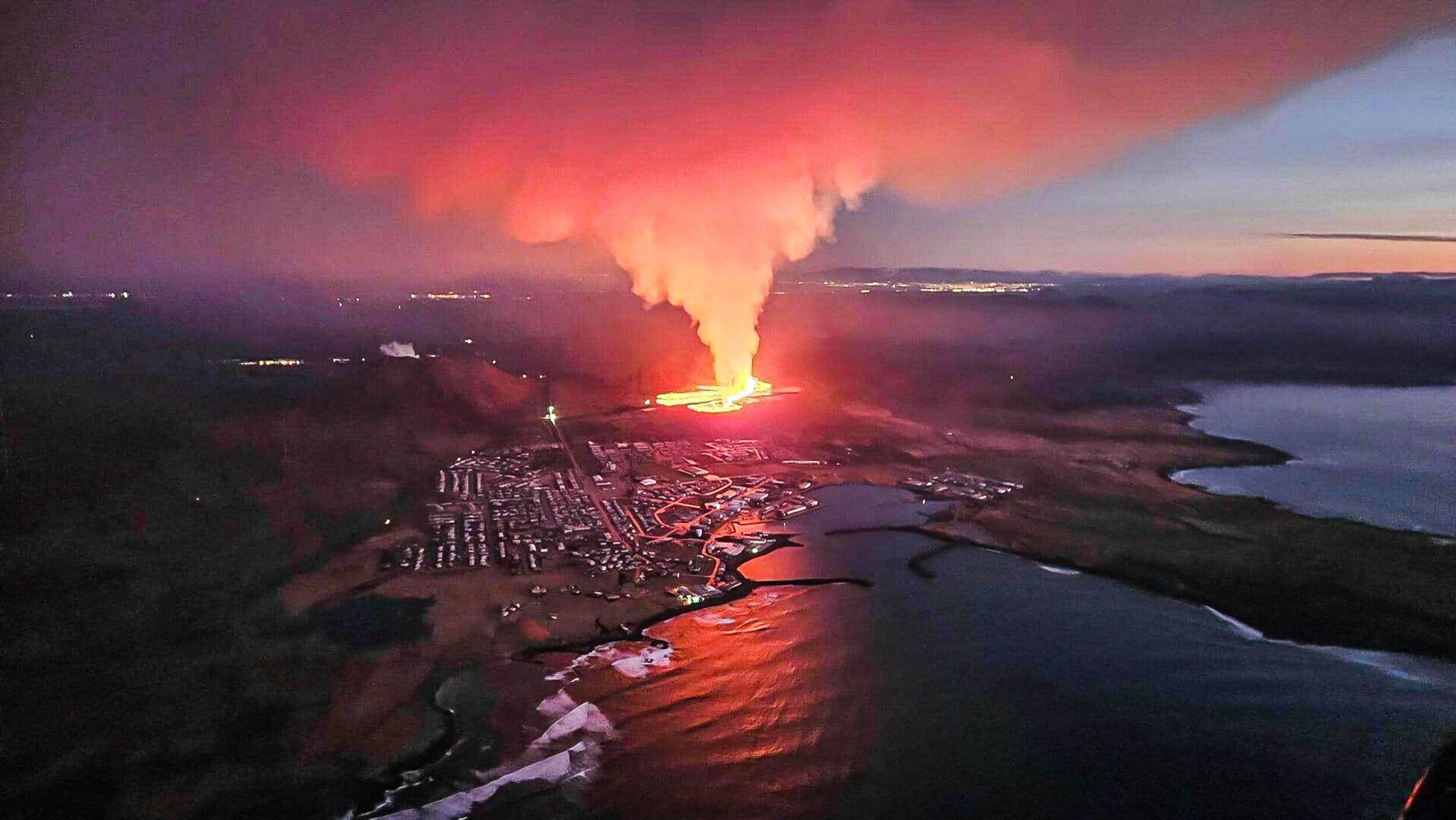
Recommended tours
Volcanic Wonders with Grindavik Visit & the Blue Lagoon
Embark on a carbon-neutral journey through Iceland’s stunning volcanic landscapes. Enjoy a refreshing hike across a lava field, formed by recent eruptions, and then unwind with a soothing soak in the healing geothermal waters. This perfect combination of adventure and relaxation offers an unforgettable way to experience the raw power and serene beauty of Iceland’s natural wonders.
City Sightseeing & Wonders of Iceland
Take a bus tour with City Sightseeing and explore Reykjavík at your leisure, with the opportunity to hop on and off at conveniently located bus stops. At Perlan – Wonders of Iceland the latest science, and the best museum artists and technologists have joined forces to create an unforgettable experience that brings Iceland’s natural wonders to life through interactive exhibits and cutting-edge technology.
- Limited availability!
Iceland Eclipse 2026 Glacier Hike – Summit Snæfellsjökull for Totality
Hike to the peak of Iceland’s most mystical glacier-volcano for an unbeatable view of the Iceland Eclipse 2026. This once-in-a-lifetime tour offers an epic glacier ascent, panoramic views, and a front-row seat to one of nature’s rarest celestial events - above the clouds!

Volcanic Wonders with Grindavik Visit
Once a bustling fishing village, Grindavík now serves as a stark reminder of nature’s relentless power. After a recent volcanic eruption forced the evacuation of its residents, much of the town remains uninhabitable, its landscape forever marked by the destructive forces of the earth.
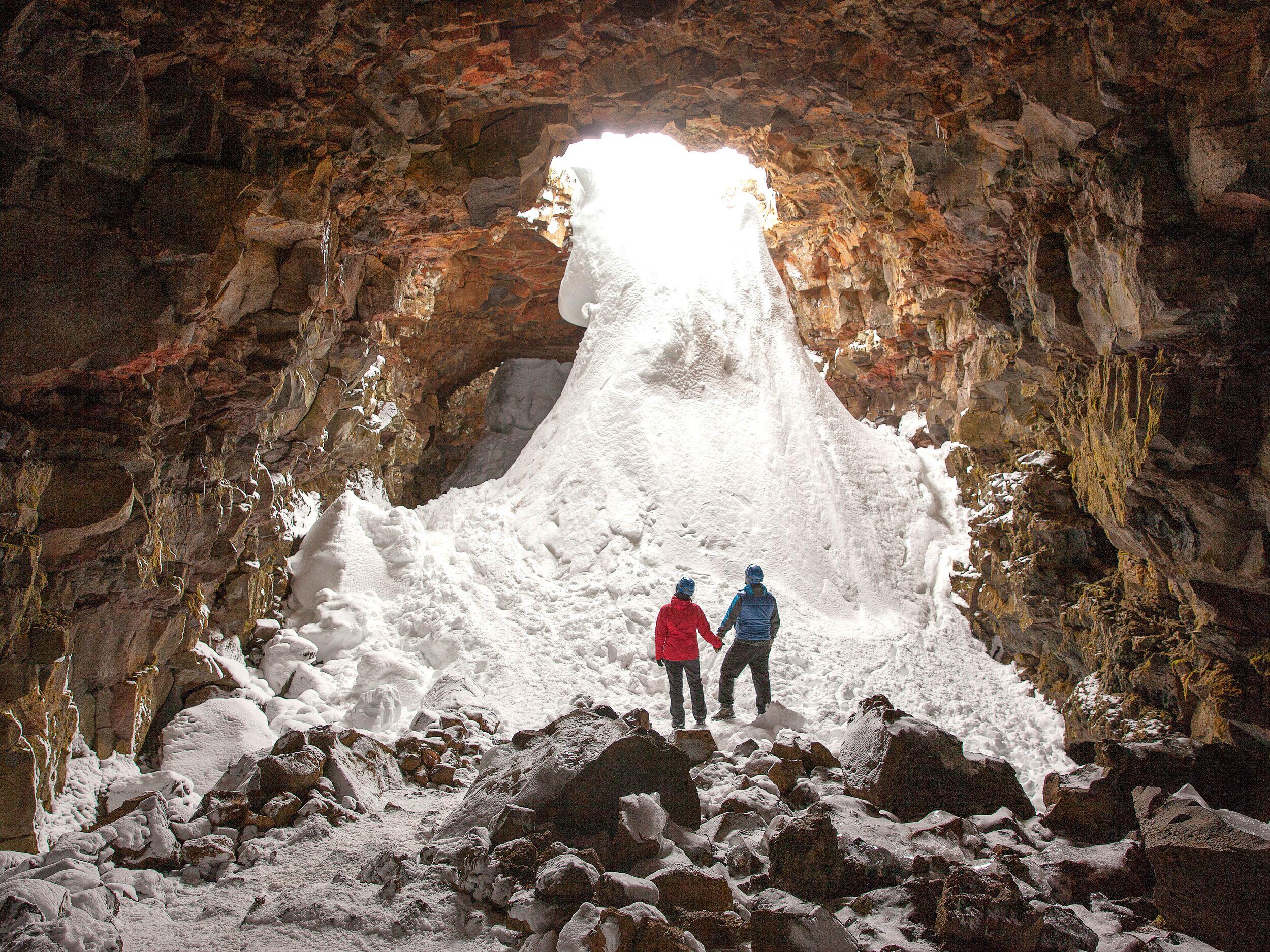
Askur Ice Cave Adventure
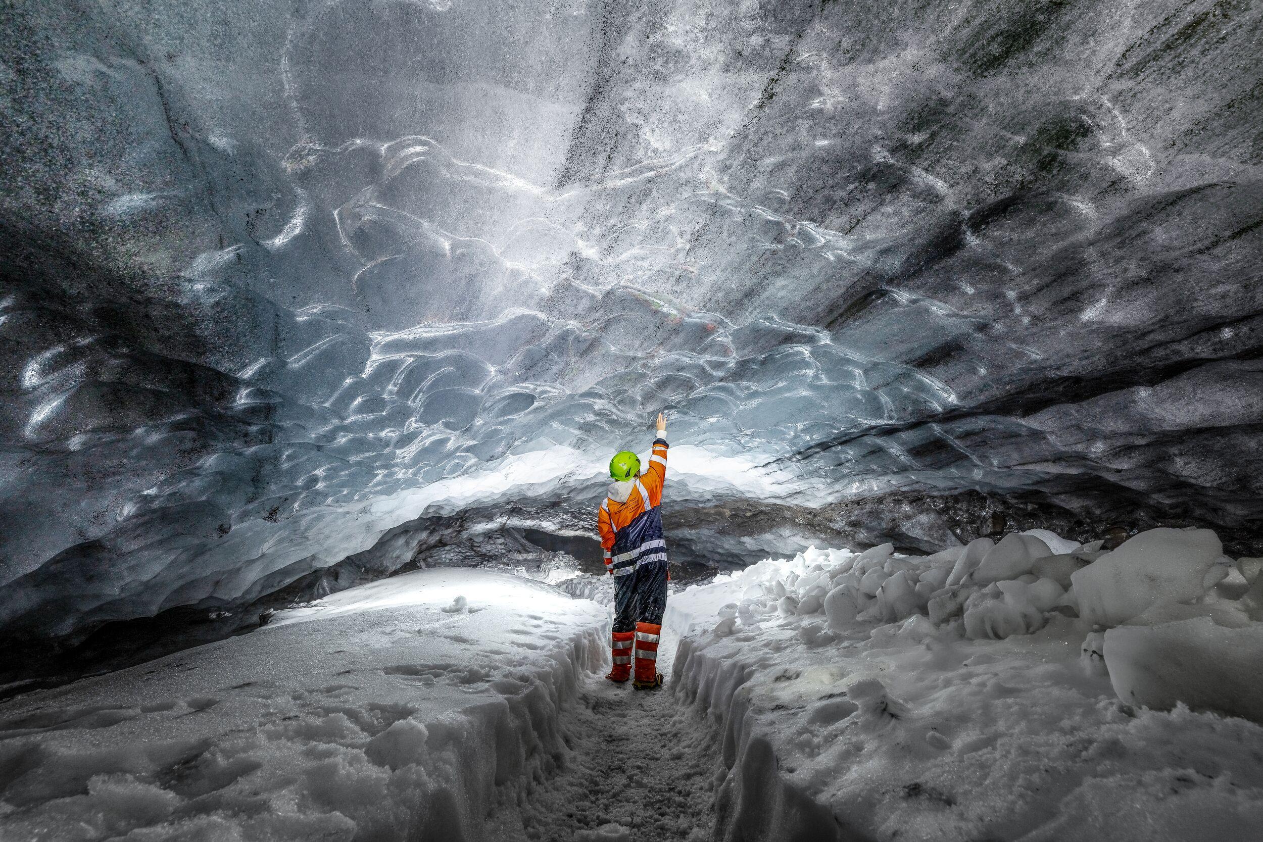
Explore the breathtaking natural ice cave nestled within the Mýrdalsjökull glacier. Wander through a shimmering ice tunnel, marvel at the intricate ash layers from nearby eruptions, and immerse yourself in the surreal atmosphere. Enjoy a thrilling buggy adventure with fantastic views.

Glacier Discovery - 3-hour Sólheimajökull Glacier Hike
Join this easy, short glacier hike and explore the beautiful, icy wonderland of Iceland’s Sólheimajökull Glacier. Enjoy the fresh air, interesting shapes and hues of the ice and marvel at the vast and remote slice of south Iceland. Led by an expert guide, get up close and personal with one of the country's most famous glaciers!