Iceland & Greenland: The Arctic Epic
| All
In this post, we want to show you exactly what you can expect from a journey that you could (so we will) call the Arctic Epic. Curious? Good. So let’s get started.
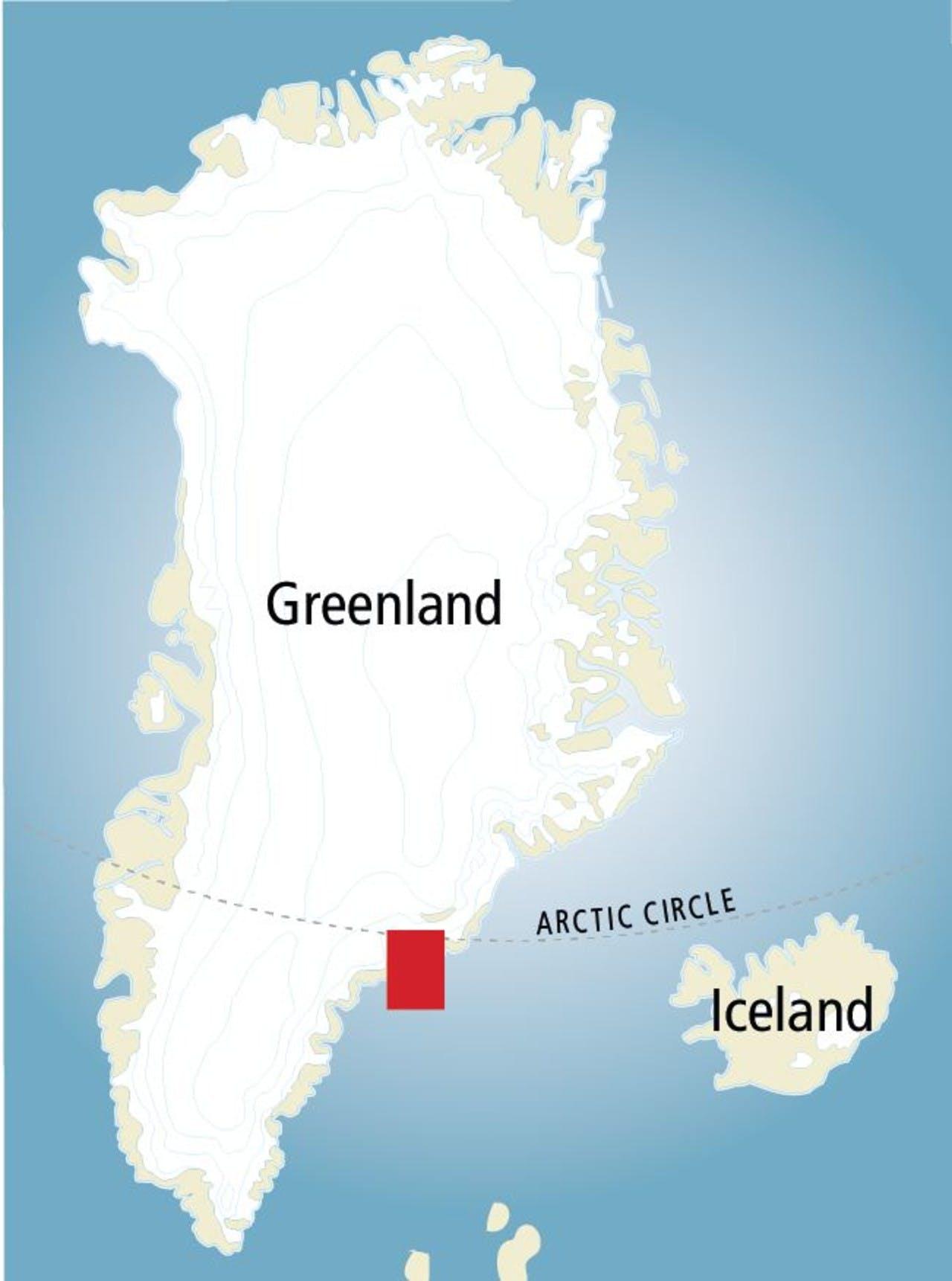
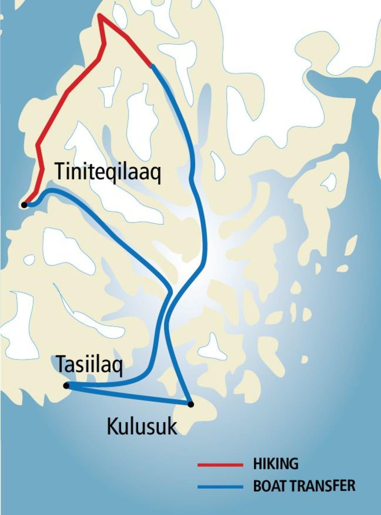
Imagine flying into Iceland to take on Iceland’s longest defined hiking trail; you wrap it up, piece of cake, and then you take the adventure to Greenland for the second half. What awaits you? You transfer from Reykjavik domestic airport to Kulusuk in East Greenland, where a boat transfer will take to a hike over giant fjords, with a view of the second largest ice cap on the planet.
Welcome to the Arctic Epic, the great adventure combination of Iceland and Greenland. Now, let’s go right back to the beginning and take this from the beginning, starting with Iceland.
The Laugavegur, Iceland

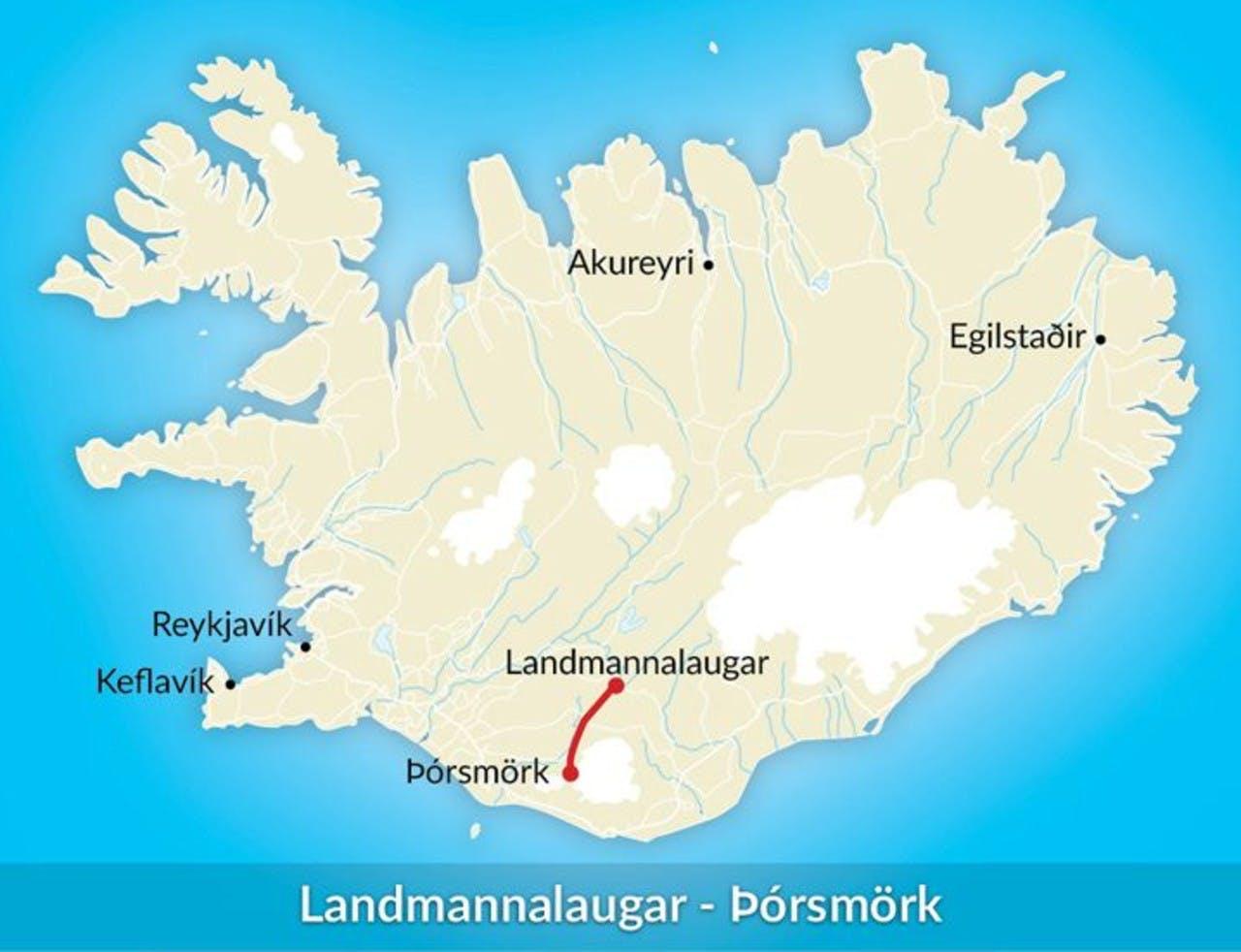
It’s difficult to know where to start when describing a trek such as the Laugavegur; it’s not by accident that it has gained worldwide popularity with trekkers, hikers, ultra-light hikers and trail runners. If you want to get to know Icelandic terrain (virtually) in it’s entirety and you have 2, 3 or 4 days for a hike (depending on how fast you want to do it, we cover ALL THE OPTIONS), then the Laugavegur is for you. At 49 miles, it is the longest defined hiking trail in Iceland.
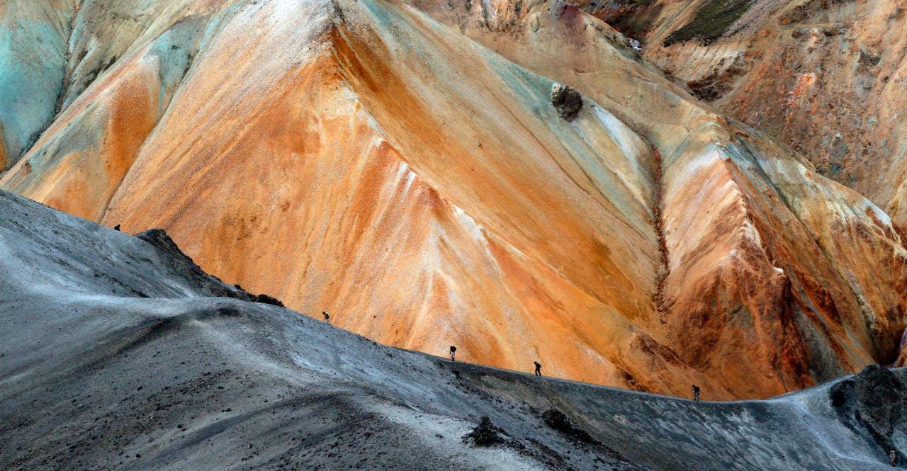
You start at Landmannlauagar, a remarkable location well within the highlands of Iceland at 500m elevation. You first days journey takes you through Laugahraun, a giant lava field and then between orange rhyolite mountains, climbing an additional 500m in elevation to the mountain plateau at Hrafntinnusker
The second stage sees mostly descent. If it wasn’t magical enough, this is where the fun really begins. Magnificent, wide open vistas, green, snow-capped and yellows peaks rise all around as you gradually descend. At the end of day 2, you finish in Álftavatn, Swan Lake, so called because whooper swans were hunted there historically.
The third stage sees you descending further towards Thorsmork, stopping at Botnar/Emstrur, a desolate grazing area used for pastoral farming; you’ll also have to to take you shoes off and ford a river or two (maybe its three; OK it's three) to make it over!
The fourth and final stage of the journey for sees the landscape erupt into verdant splendor as you make your final descent in Þórsmörk, Thor’s Woods. It’s a spectacular location, carved out by glacial rivers, it is one of the greenest places in Iceland. A truly fitting end to a spectacular journey
From the Sun Gate to the Icefjord

So, once you are done with Iceland’s greatest hiking trail, you’ll be ready for Greenland. Because If you thought Iceland was big on landscape, just wait. When you trek up from the Qinnertivaq fjord over and down into the Sermilik fjord, with gigantic alpine granite mountains on either side, forged, pressed crushed and countered by ice, you get a sense of how enormous they really are. They are enourmous. We kind of want you to take our word for it. Before descending down into he next fjord, you can get more than a glimpse of the Greenland Ice cap, the second largest ice cap in the world! The sense of scale is very important, it’s a recurring theme when in Greenland, because it’s just such a humbling experience to be surrounded by this tempestuous
How about stopping to fish some fresh, wild Trout as well? Not as weird as it sounds, there is plenty of it, and someone has to eat it! Once you have tried your hand at that, on the other side, the journey takes you to the the tiny hunters village of Tiniteqilaaq, population 134 in 2010. Get a glimpse of a simpler life before catchign the boat back to Kulusuk.

The Arctic epic is quite a ride, a feast for the eyes, a rollercoaster for the feet, an exuberantly beautiful journey that gets you through some o nth very best of these two Arctic and ear Arctic landscapes. The only way to really understand these lands is to see them for yourself. Start planning your unforgettable adventure in Greenland.
Keep me informed about the Icelandic Mountain Guides Blog
Outdoor adventure in Iceland is our specialty. Subscribe to our free monthly newsletter to learn when to go, what to do and where to have the best adventures in Iceland.