Expeditions
A Fantastic Experience in the Wilderness of Greenland Price from: 19.500 EUR
Tour code: EXPG64
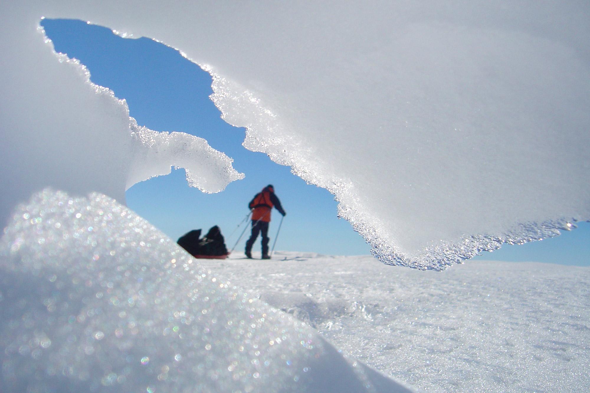
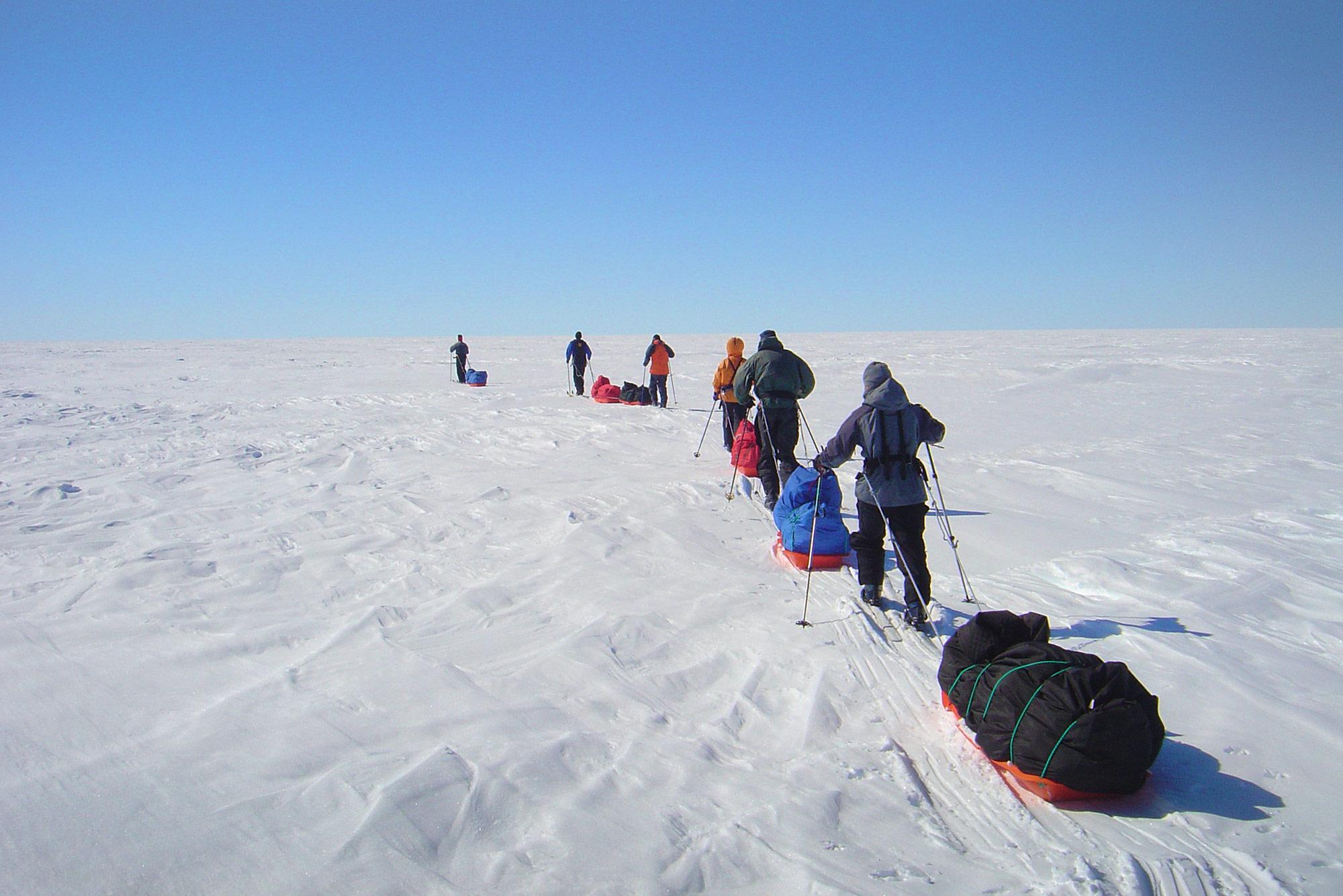
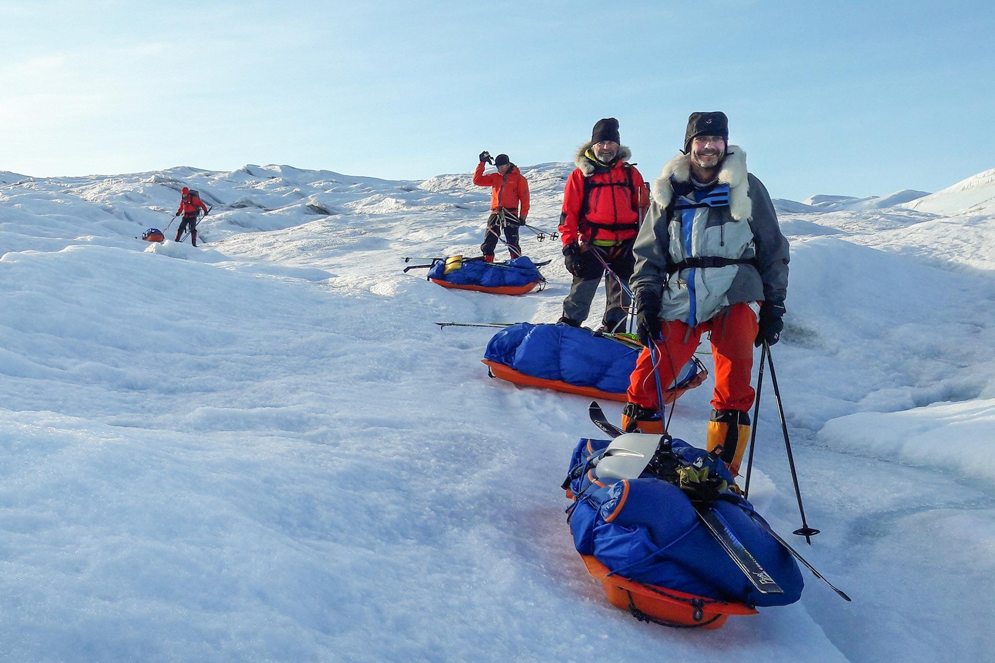
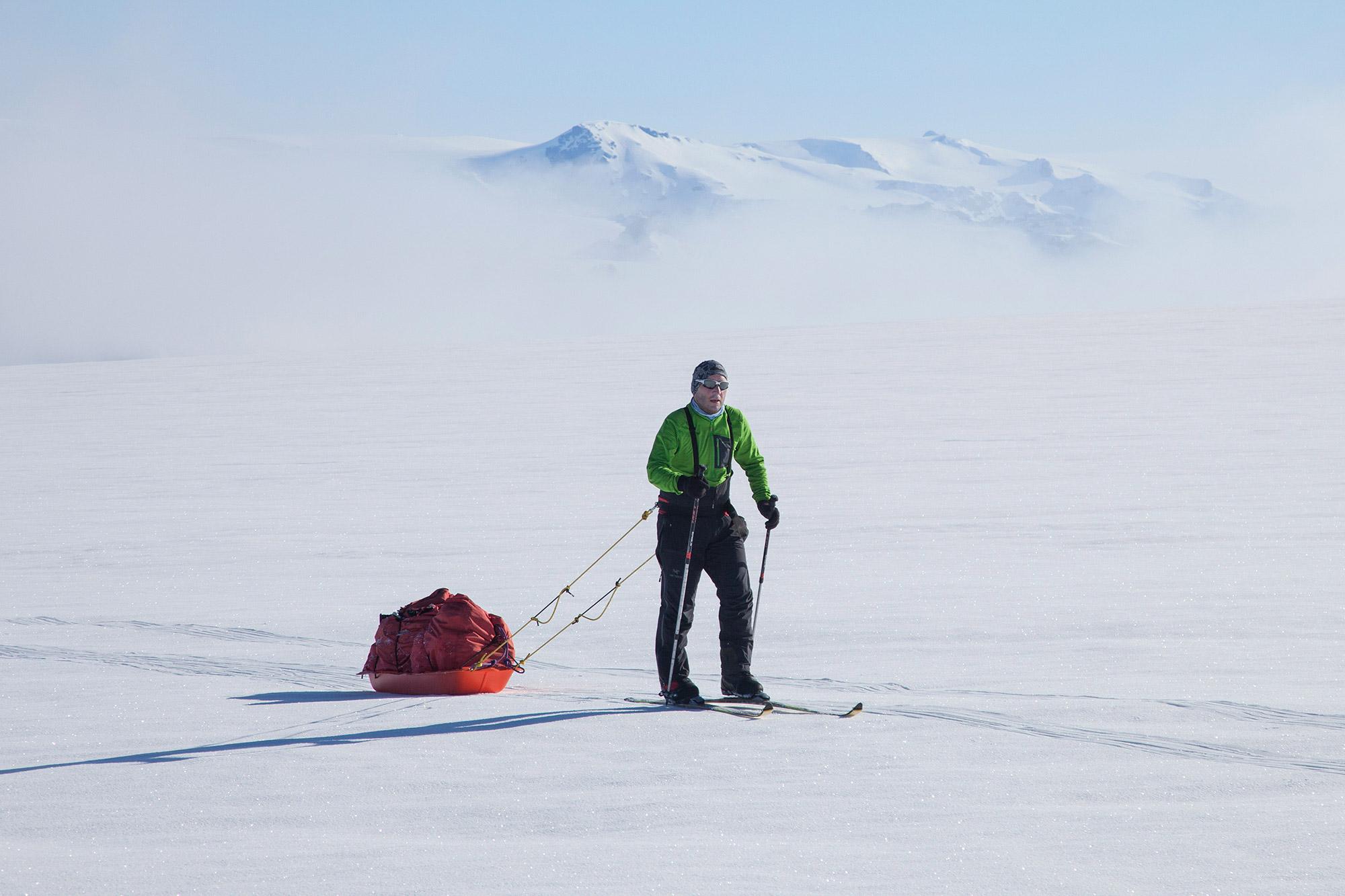
The aim is to cross the interior of Greenland Glacier. The expedition starts from Ammassalik on the east coast to Kangerlussuaq (Sondre Stromfjord) on the west coast. The entire expedition will take up to 34 days in total. So far, IMG's success rate is 100%.
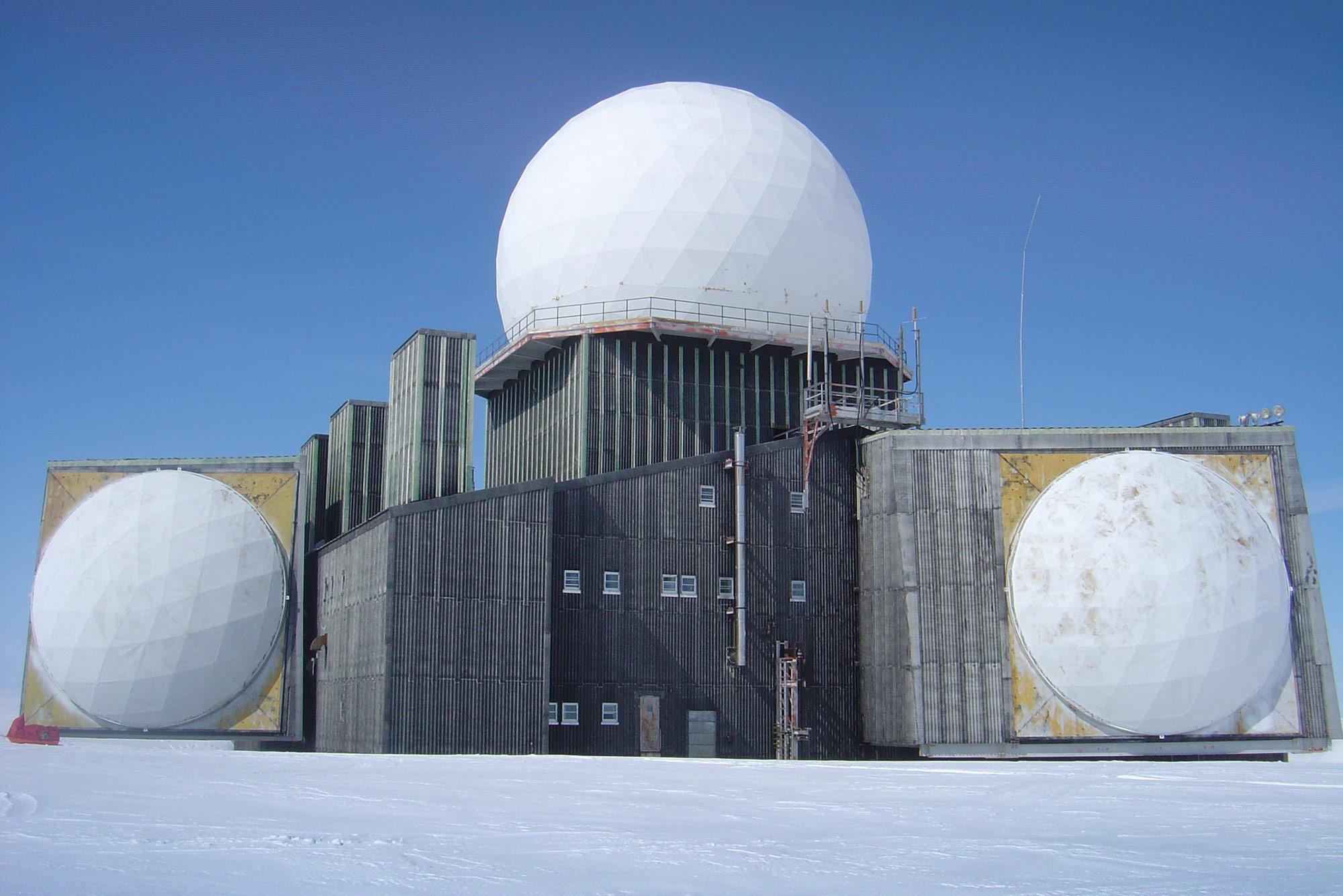
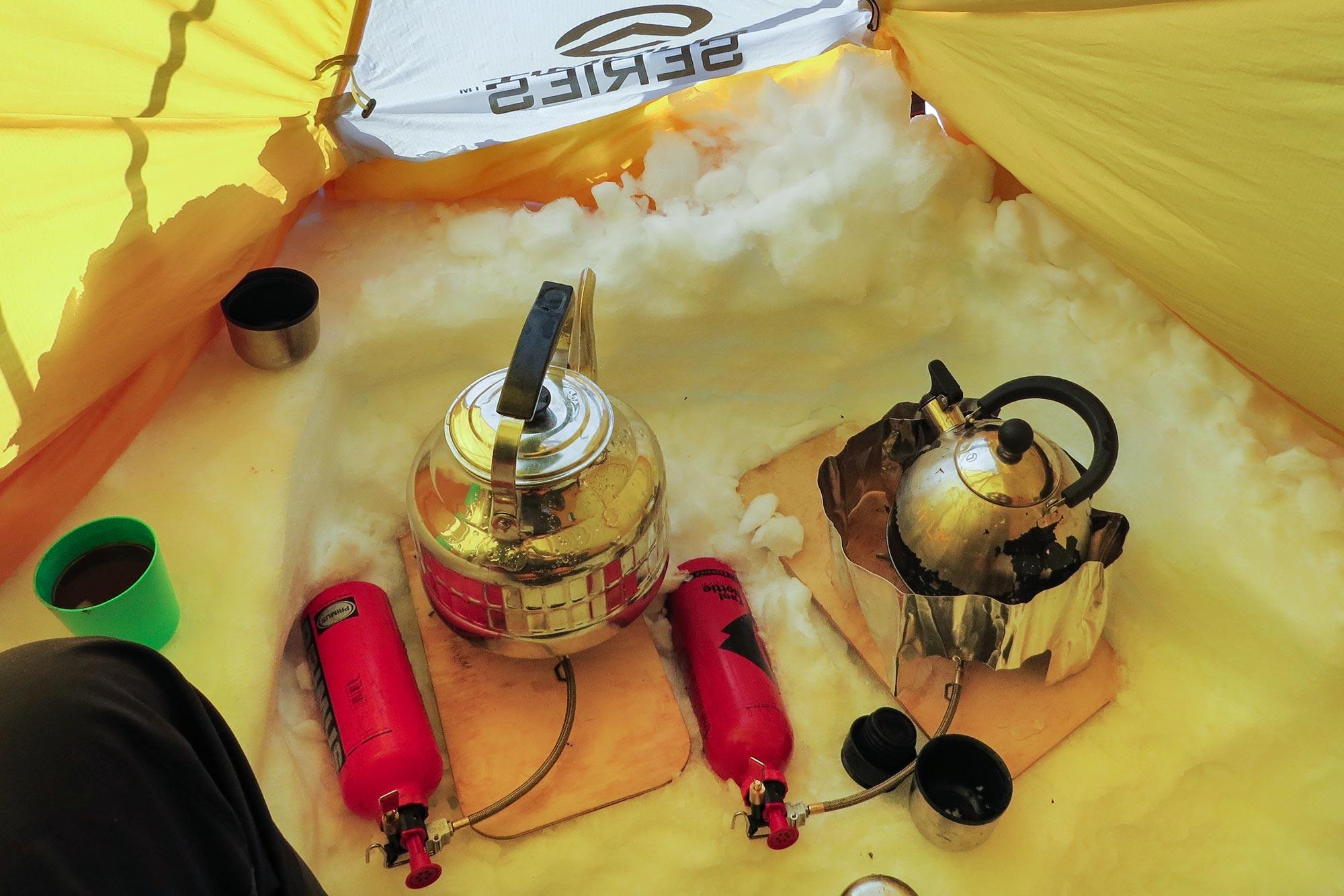
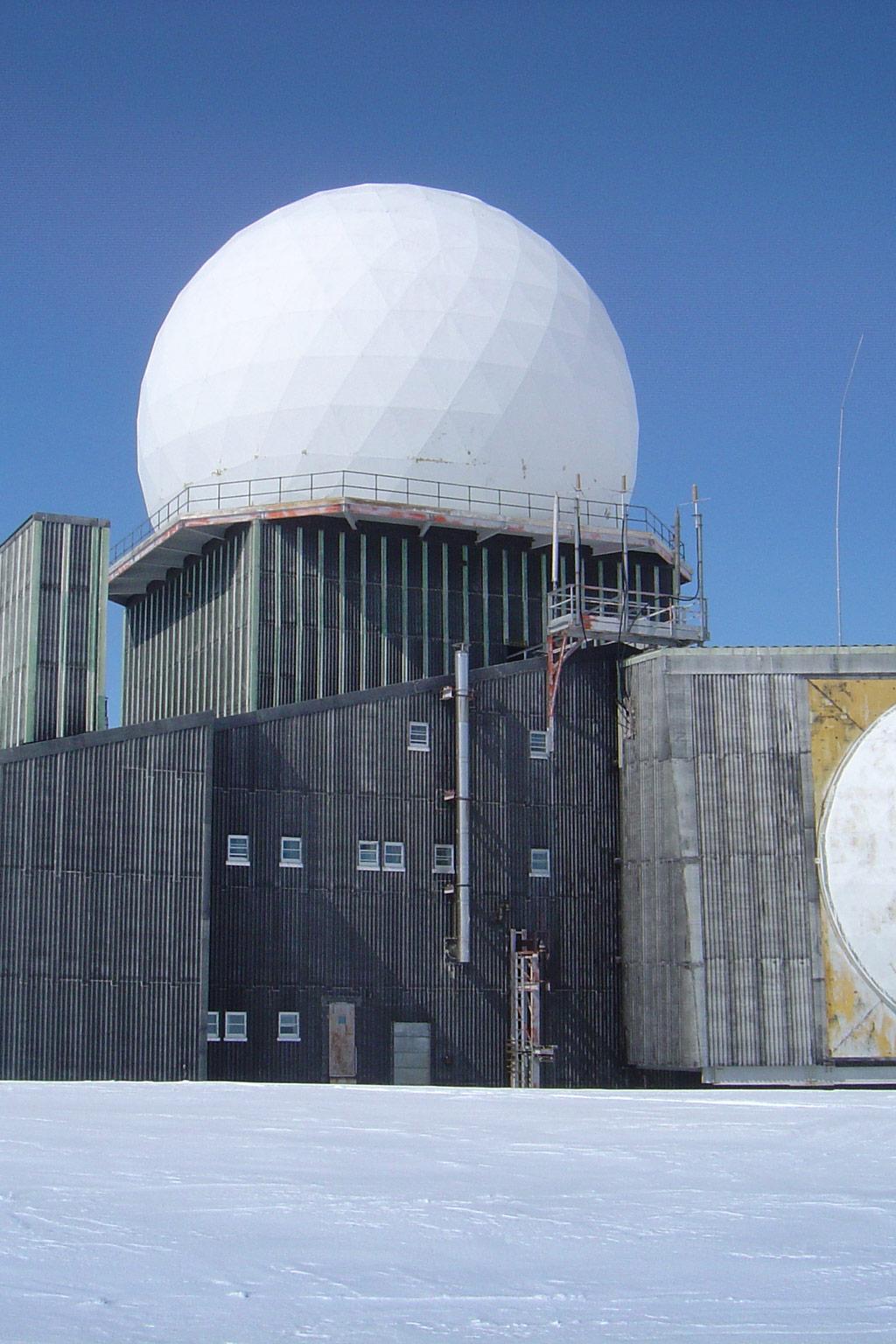
It takes about 10 days to climb up to the highest part of the Ice Sheet on this route, topping off at an impressive 2500 m. The gradient is gradual and the use of skins makes sure that the skis move us forward. From the summit, it takes about a week to get to the historical phantom radar station DYE 2, surely one of the most bizarre buildings on the planet that was used to monitor the Russians during the Cold War. From this strange place, it takes from around 5 days to get to Terra firma - Hill 660, the landfall on the westerns side of the ice sheet.
Depending on the snow conditions and the weather we encounter, the expedition can last from 21 - 30 days in total including transport at the beginning and the end of the expedition. For any backcountry enthusiast, this is the ultimate expedition” Where one needs to overcome several challenges, and not all of them are physical! A stunning life experience.
“Our guide, Maxime Poncet, was beyond brilliant, with a wonderful ability to get everyone talking, loads of interesting stories, and never-ending patience and good cheer. We had a lot of fun together as a group and I really didn't want it to end! Testament to the quality experiences that Icelandic Mountain Guides provides, I will be returning to East Greenland in 2018 to trek their "Inuit Trail", and at least 3 of my trekking companions on Unplugged Wilderness had trekked with Icelandic Mountain Guides before as well. Fantastic Company! Can't wait to return!”
Preparatory meeting in the morning with the expedition leader. Exact time and location to be announced.
Flight Reykjavík - Kulusuk - Tasiilaq
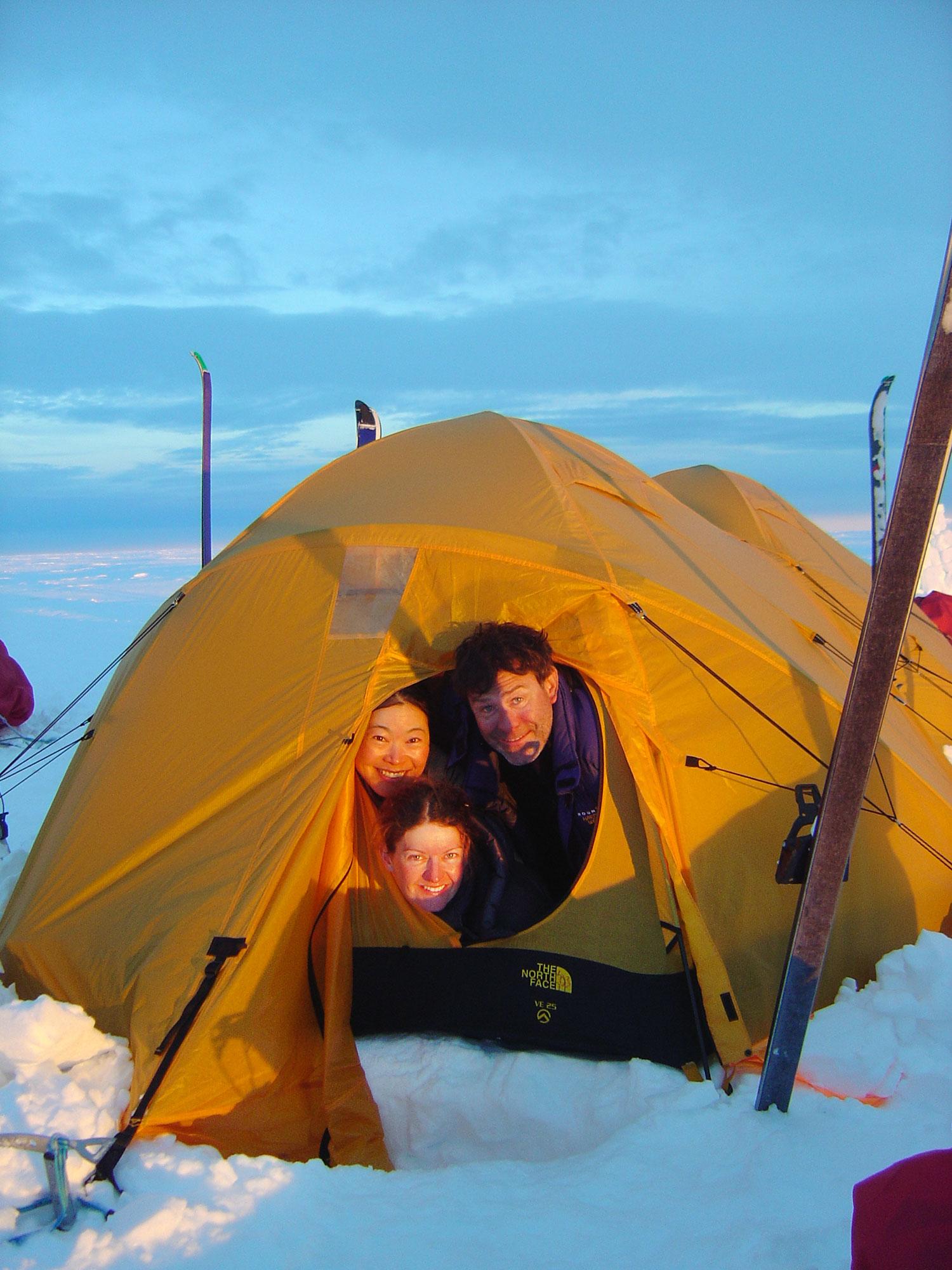
Final preparation, the necessary inspection of gear etc - overnight in Tasiilaq guesthouse.
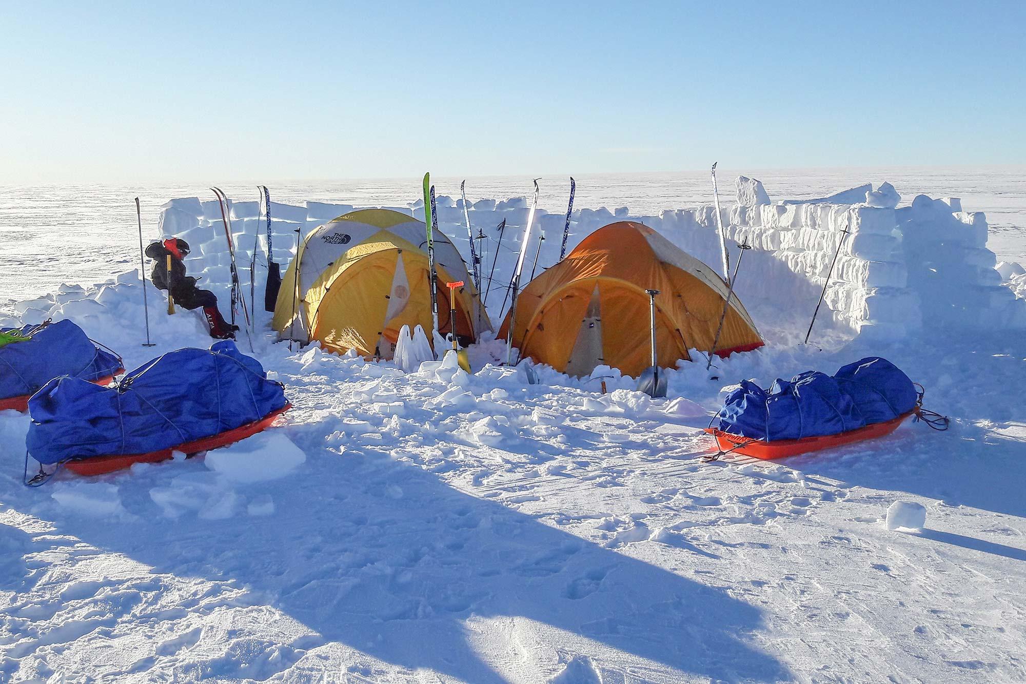
Transfer to Isortoq/Hahn glacier - start of the Crossing
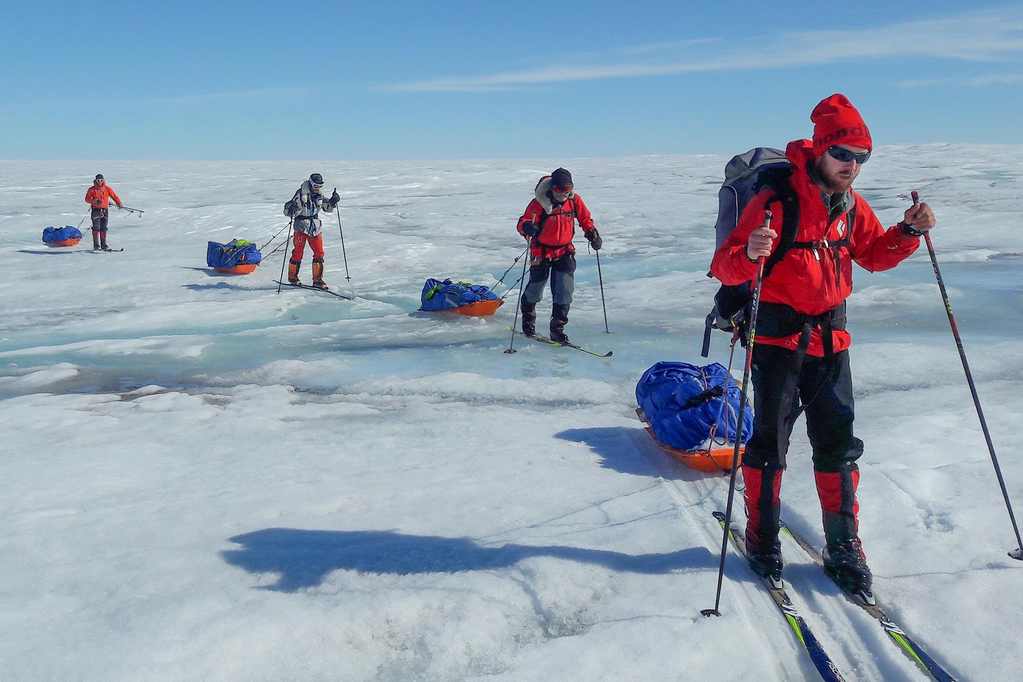
Skiing up to the summit. It takes about 10 - 15 days to climb up to the highest part of the Ice sheet on this route, topping off at 2500 m (8200 ft). The gradient is gradual and the use of skins make sure that the skis move us forward.
Skiing down on the west side of the Ice sheet, arriving at Hill 660.
Hiking from Hill 660 to Kangerlussuaq (optional). Flight to Reykjavík (scheduled on the 15th of May), expedition ends.
The Greenland Crossing - a Real Polar Expedition
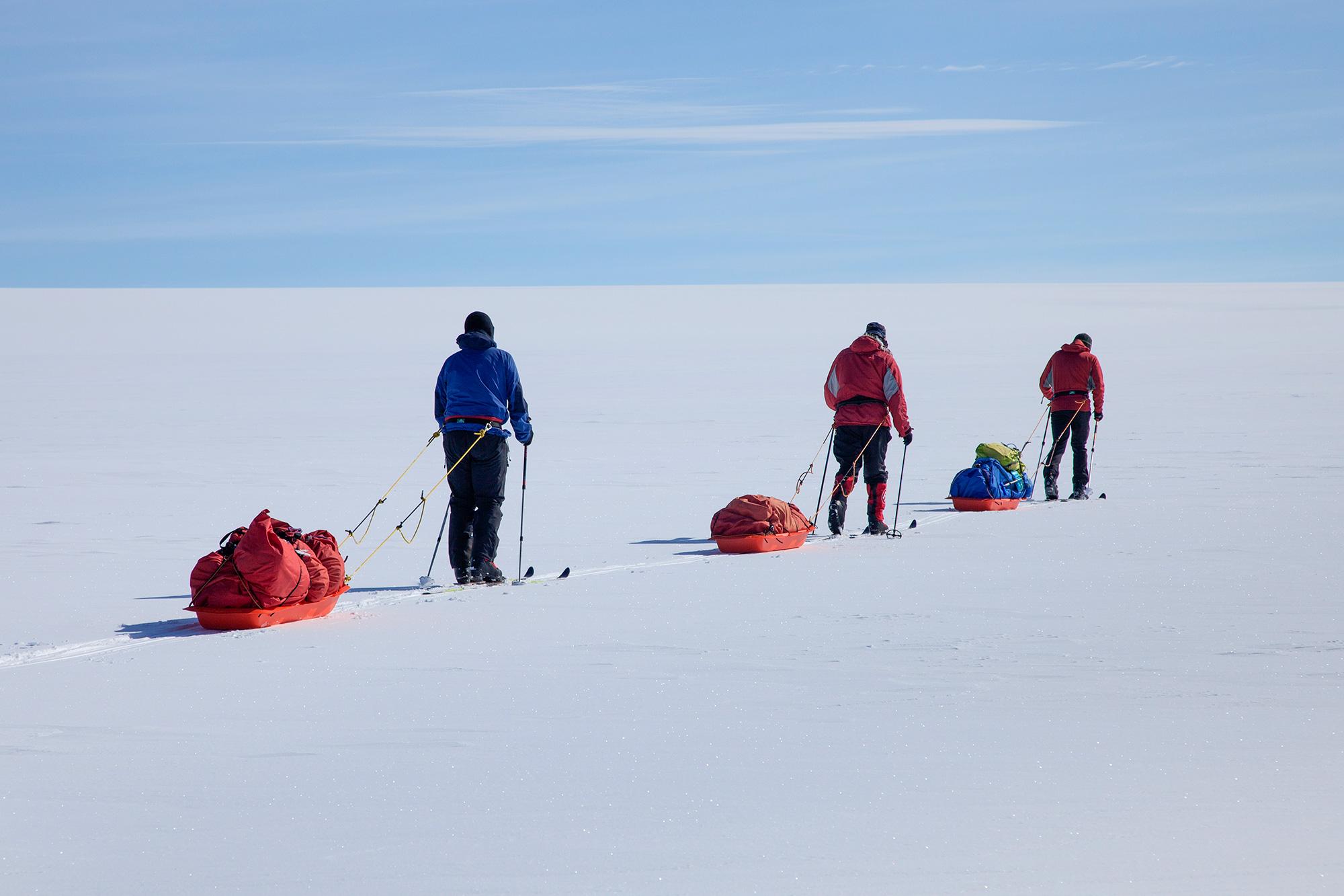
The expedition begins at Reykjavik city airport, on April 13th 2017, with a flight to Kulusuk, Greenland and then a helicopter transfer to Tasiilaq, the capital of East Greenland. The group will stay in Tasiilaq for one or two nights, sorting out equipment and food and dealing with the final preparations before setting out. From Tasiilaq the group will be flown by helicopter up to Hahn-glacier at about 900 m (2700 ft) altitude, where the skis will take over for the next 540 km (335 miles) or so.
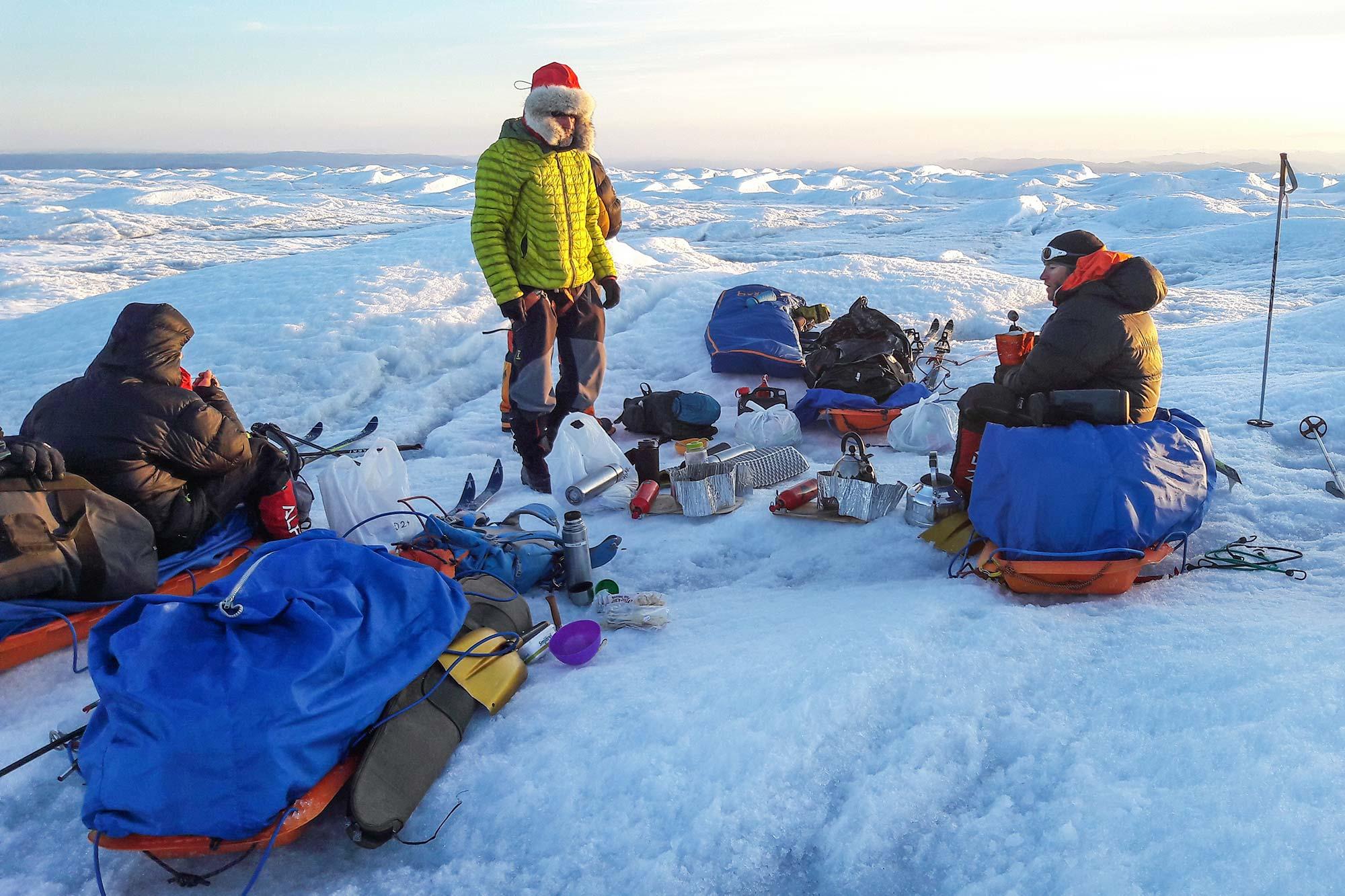
It takes about 10 - 15 days to climb from the Hahn glacier up to the highest part of the Greenland ice sheet, at 2500 m. From there it takes about a week to get to the phantom radar station DYE-2, one of the strangest buildings to be found on the planet, and then it takes approximately five days to reach land at Hill 660 at the western edge of the ice sheet. All in all we estimate spending from 22 to 27 days on the ice sheet.
Hill 660 is in fact a nameless hill close to the glacier that measures 660 m above sea level in height. A jeep track lies from the hill which is beneficial for expeditions coming off of the ice sheet as both people and luggage can be taken by car the last 35 km (21.7 mi) to Kangerlussuaq. However, a hike back to civilization may be a welcoming thought for expedition members as the landscape is quite dramatic providing brilliant contrasts to the endless snows of the ice sheet. The fauna of the area is also truly remarkable. Reindeer, muskoxen, snow hares and arctic foxes can be seen in big numbers and during this period the lakes are still, mostly ice covered keeping the mosquitoes away.
If the expedition has made it in good time over the ice sheet, nobody is pressed for a return flight from Kangerlussuaq, and all expedition members are still in good health, without any blisters or foot aches, there is a possibility of doing the hike, either in part or as a whole, down to Kangerlussuaq carrying only a light pack. This will be decided by the guide and all expedition members once the expedition has reached Hill 660.
For further information contact us: incoming@mountainguides.is
Outdoor adventure in Iceland is our specialty. Subscribe to our free monthly newsletter to learn when to go, what to do and where to have the best adventures in Iceland.